Eagles Nest Wilderness Access from Resort Communities
Eagles Nest Wilderness Access
Eagles Nest Wilderness is one of Colorado’s larger wilderness preserves. It's centrally located within the state and conveniently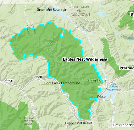 surrounded by some of Colorado’s favorite resort communities. This location combines access to 135,204 unadulterated wilderness acres with convenience to all the amenities and luxuries Colorado’s resort communities offer. This wilderness can be conveniently accessed at its most southern point across Interstate 70 from Copper Mountain’s parking lots. On the western side, the wilderness can be accessed from the Vail area. On the eastern side, access extends from Frisco to Green Mountain Reservoir.
About the Eagles Nest Wilderness
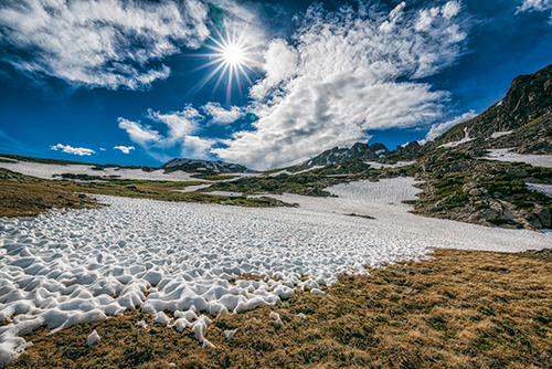
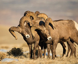
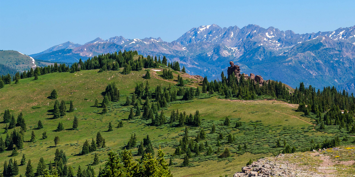
The Eagles Nest Wilderness surrounds Summit County’s Gore Range, a craggy upheaval separating the communities of Silverthorne, Frisco, Copper, and Vail. This assembly of jagged peaks is among Colorado’s most abrupt and beautiful ranges. Below its dizzying headwalls like blue lakes that stair-step downward through broad valleys. The surrounding forests, largely spared the ravages of the mining era, contain regal stands of old-growth spruce and fir. They provide a habitat for mountain goats, black bears, mountain lions, elk, and several other species.Real Wilderness
The Eagles Nest is real wilderness. Most of its peaks are unnamed, except for a loose confederation of brave mountaineers who have risked their lives to climb them and granted them their names. The Eagles Nest hosts several spectacular peaks with alpine summits of over 12,000 ft. Mt. Powell, being the highest, reaches an impressive height of 13,575 ft. But the Eagles Nest is not just for the extreme. With no roads and expansive forests, it is a place for solitude and exploration.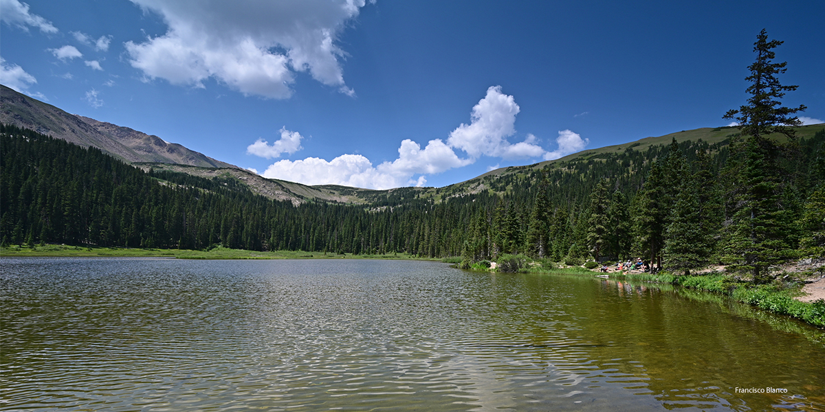
Popular Eagles Nest Wilderness Trailheads
Copper Mnt Access - Wheeler Lakes
- Gore Range TH #60—This popular trailhead is across from Copper Mountain, although the parking area and trailhead are slightly north of Copper Mountain. The trail climbs steadily up through aspen and lodgepole pine forests before reaching the two Wheeler Lakes. You can continue on the Gore Range Trail up to Lost Lake or the top of Uneva Pass if you want a longer hike.
Directions: From westbound I-70, take Exit 196, Scenic Overlook, and park in the spaces provided. From eastbound I-70, travel to Exit 198. Officers Gulch, and turn left at the stop sign. Travel underneath I-70 and take the westbound on-ramp for I-70. Travel on I-70 westbound and take Exit 196, Scenic Overlook, and park in the spaces provided.
Frisco Access
- Lily Pad Lake TH #50 - is a popular trail close to Frisco. The trail travels south through thick stands of lodgepole pine and aspen. Along the way, you will cross some small streams and pass several beaver ponds. The lake is a great place to relax and enjoy. Parking is limited. Consider taking the FREE Summit Stage to the trailhead.
- Buffalo Cabin/Buffalo Mountain TH #31—The trailhead is close to Lily Pad Lake but travels north up Buffalo Mnt. A shorter hike to the long cabin ruins is an option, or you can continue to the top of Buffalo Mnt. This hike is not recommended for hikers with dogs due to the crossing of a talus field with sharp rocks. The directions to the Buffalo Mnt TH #31 are the same as Lily Pad Lake TH #50
Directions: From I-70, take Exit 205, Silverthorne/Dillon, and travel north on HWY 9 to the first traffic light at the intersection of Rainbow Drive / Wilderness Road. Turn left onto Wildernest Road (this road turns into Ryan Gulch Road). Travel for 3.6 miles to the top of Ryan Gulch Road. Toward the end of the road, a parking area will be on the left. Both trailheads leave from this parking lot; ensure you're on the correct trailhead.
Vail Access
Several more trailheads access the wilderness area between Gore Creek and Vail.- Gore Creek TH #2015 is a popular trail near the Gore Creek Campground, just 6 miles south of Vail.
Directions: Travel east on I-70 to Exit 180 for East Vail. Turn right and follow the south frontage road (Bighorn Road) east for about 2 miles to the road closure gate. The campground is on the left, just before the gate.
Green Mountain Reservoir Access
Green Mountain Reservoir accesses the Eagel’s Nest Wilderness area from the north side. This area is a popular recreation area for camping, boating, fishing, hiking, and accessing the wilderness area.- Eaglesmere TH #61 - this trail is a nice steady climb through the aspen and pine forest and ends at the Eagles Nest Peak.
- Lower Cataract Lake Loop TH #57 - a loop trail that can be hiked in either direction. A nice family hike with views of Cataract Falls, mountain and meadow scenery.
- Upper Cataract Lake TH #63 - a hike to a beautiful lake that sits on the edge of a tree line and has dramatic views of Eagles Nest Peak.
by Kathleen Fitzsimmons